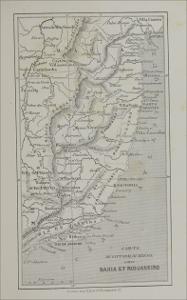
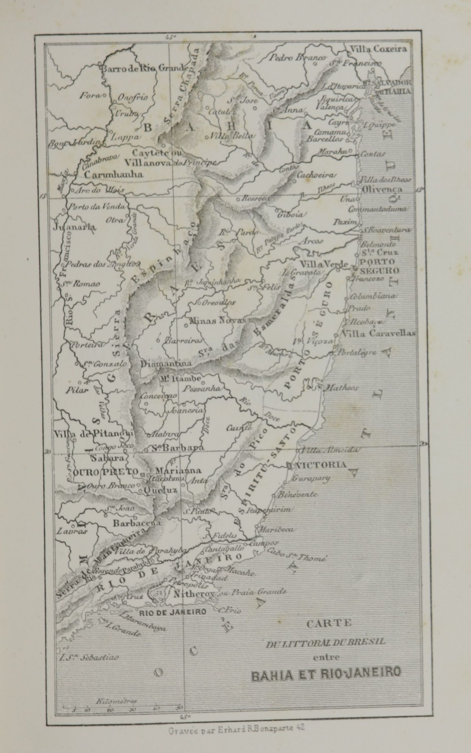
| Title: | Carte du littoral du Brésil entre Bahia et Rio-Janeiro |
| Other Titles: | Tradução do título : [Mapa do litoral do Brasil entre a Bahia e o Rio de Janeiro] |
| Issue Date: | 1862 |
| Physical Medium: | 1 grav. pb.; dimensões da imagem: 1577 x 2521 pixels; 300 dpi (resolução) |
| Part of: | bbm/4983 |
| Contributor: | Bonaparte, Erhard R. (grav.) |
| Rights: | Domínio público |
| Subject: | MAPAS DESCRIÇÃO E VIAGENS |
| Temporal Coverage: | Século 19 |
| Geographical Coverage: | BAHIA RIO DE JANEIRO BRASIL |
| Appears in Collections: | Imagens |
Files in This Item:
| File | Description | Size | Format | |
|---|---|---|---|---|
| 002856_IMAGEM_037.jpg | 386,47 kB | JPEG |  View/Open |
Items in DSpace are protected by copyright, with all rights reserved, unless otherwise indicated.